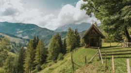
© TVB Werfenweng, Christian Schartner
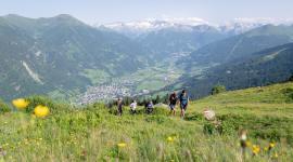
Dem "Blauen Enzian" folgen und gemütlich von Alm zu Alm wandern. Sich dabei ein gemächliches Tempo gestatten, imposante Landschaftsbilder genießen, die vielfältigen Aussichten und die Welt der Berge und Seen in Salzburg mit jedem Atemzug in sich aufnehmen...
Auf dem Salzburger Almenweg bleibt der Alltag im Tal zurück. Er ist einer der schönsten Weitwanderwege in den Alpen. Auf 25 Etappen laden rund 120 Almen im Salzburger Pongau zur gemütlichen Einkehr und natürlich zur kulinarischen Stärkung mit herzhaften Almspezialitäten.


 Gasteinertal Tourismus GmbH, Christoph Oberschneider")